

Europe

Aegean Sea, ORIGINS
This chart belongs our ORIGINS range and it features Aegean Sea, which is an elongated embayment of the Mediterranean Sea between Europe and Asia. The Aegean is connected through the straits of the Dardanelles, the Sea of Marmara, and the Bosporus to the Black Sea,...
Cork Harbour B&W
Cork City is located upstream on the River Lee on the northwest corner of Cork Harbour. Several of the city’s suburbs, including Blackrock, Mahon, Douglas, Passage West and Rochestown lie on Lough Mahon or the Douglas Estuary, both of which are parts of Upper Cork...
Marmaris, Korfezi, Bodrum, Turkey
This beautiful chart features Marmaris, Korfezi, Bodrum in Turkey with an amazing story… A sailing friend contacted me while chartering in Türkiye. They were tied up next to a beautiful Amel 50 in Gocek, conversation ensued: “Where are you from?”...
Zürich, ORIGINS
The arrival of a new born baby brings immense joy and celebration for all concerned. Yes we all want to give a unique gift that will be cherished for life, …hmmmm, not so easy. The normal gifts are generally ‘nice’ baby clothes that might get ten outings before they...
Shipping Ports, Storyboard
This is our Storyboard Chart Range – Each 3D captures an event which could be a home port, a favourite destination, a funny story, a memorable cruise or whatever you think is worth telling as a story. The events are grouped together in one frame to tell the story....
The North Sea, B&W
This beautiful B&W chart features The North Sea. It also includes the coastline of Norway, Sweden, Denmark, Germany, Holland and Belgium. The North Sea lies between Great Britain, Norway, Denmark, Germany, the Netherlands and Belgium. In the southwest, beyond the...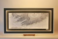
Valentia to Cork
The south west coast of Ireland is known for its beauty and is a major holiday location whether by land or by sea. Attached are photos of two versions of the same area. Both are beautiful charts of the south-west coastline from Valentia Island, Co. Kerry to Cork...
Thames Estuary Admiralty Light Chart
This sector light chart features the River Thames Estuary includes the Isle of Sheppey on the south of the Estuary, and Southend-on-Sea and Foulness Island on the north of the estuary. Nautical charts have instant appeal to anyone with an interest in the sea. The...