
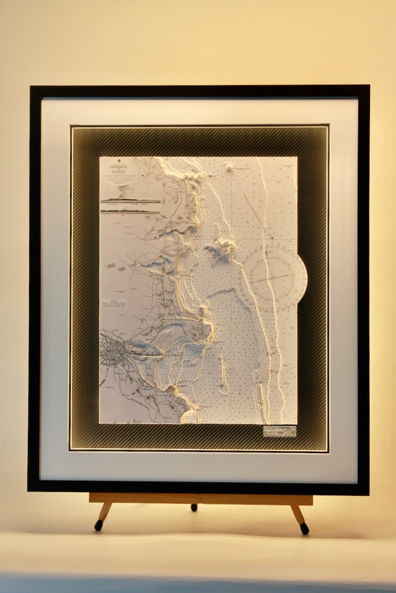


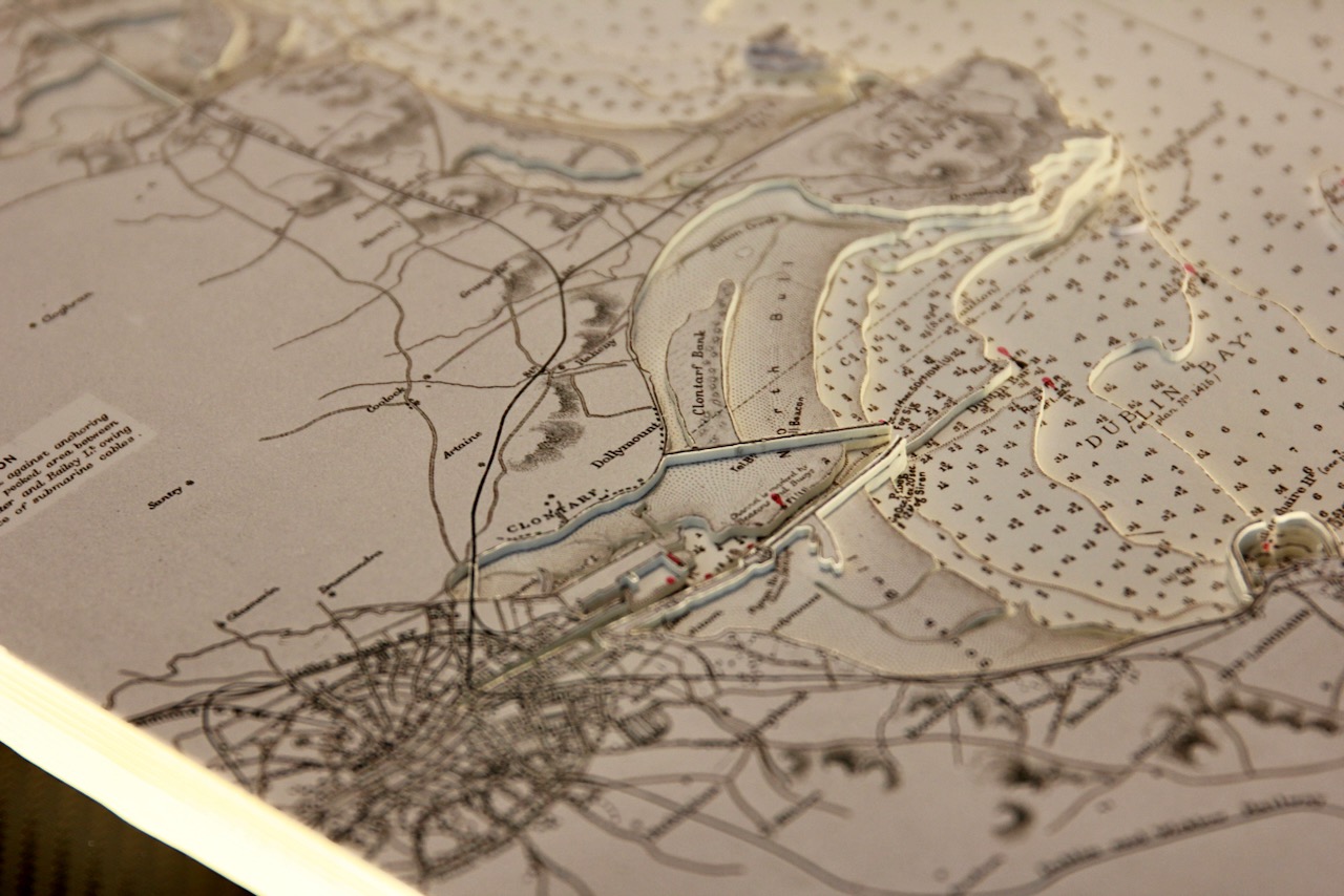


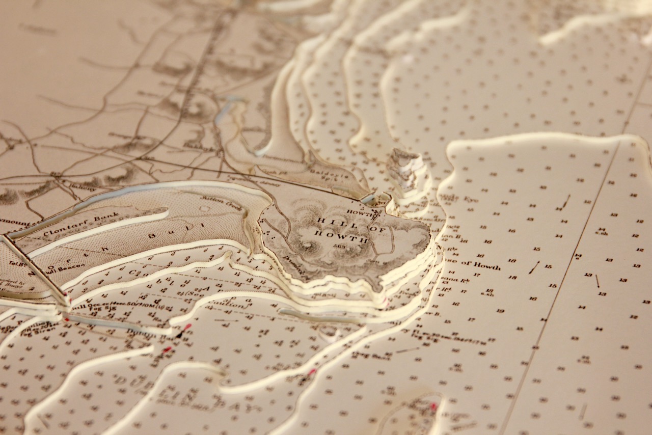
This lovely black and white 3D chart features Dublin’s coast from Skerries as far as Dalkey. Iconic Dublin landmarks such as Howth Head, the Dublin docklands and Dun Laoghaire’s east and west piers are all shown.
At the top of the chart, Skerries Islands can be seen lying offshore. The seaside town of Skerries has five islands off its coast. These are Shenick Island, St Patrick’s, Colt and Rockabill. Rockabill is in fact two islands, The Cow and The Calf, separated by a narrow channel. Rockabill is home to Skerries lighthouse.
We used a nice artistic technique on this chart in floating the compass rose which creates a pleasing sense of balance.
The surround lighting gives a soft golden glow when illuminated. This is set on a vinyl carbon mount and black frame combination.
Specification: Location: Skerries to Dalkey B&W, Ireland
Chart: Classic B&W, UKHO
Frame: Black
Size: 600*500mm
Double Surround Mount
Backing mount: Vinyl Carbon
Surround lighting – LED 12V DC with Mains Interchangeable UK, Euro & US Plugtop
COMMISSION OPTIONS : Alternative options : Larger size, Colour modern charts. Framing options to suit all settings. Surround lighting with carbon backing. Design to match specific customer requirements.
Bobby Nash developed the Latitude Kinsale brand to be synonymous with quality, innovation and delivering excellence to any location in the world. The 3D chart’s are hand made to commission with care and attention to detail and to exacting standards gained from 20 years of experience. All materials used to create the 3D chart are paper based, acid free, age resistant, conservation quality, designed to protect the chart and achieve the highest levels of presentation for framing.
Any Chart, Anywhere in the World.