
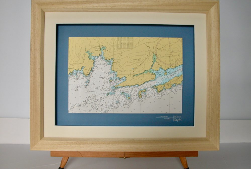


Located on Ireland’s southwest coast, Toormore Bay is situated in a coastal bight that lies between Crookhaven and Long Island. The Toormore Bay is a sheltered bay in the middle of one of the most beautiful areas of West Cork. Note how the coast is particularly indented around Toormore Bay and Ballydivlin Bay. This makes for very detailed 3D application.
At the tip of the peninsula is Mizen Head which is a major tourist attraction and is noted for its dramatic cliff scenery. The tip of the peninsula is almost an island, cut off by a deep chasm, now spanned by a bridge; this gives access to an old signal station, a weather station, and a lighthouse. The signal station, once permanently manned, is now a museum.
The chart also captures Long island, Goat Island and Coney Island. The chart has a nautical look and is set on a marine blue background and has a cream mount and an Oak frame.
Specification: Location: Toormore Bay, Ireland
Chart: Modern Colour UKHO
Frame: Oak
Size: 600*500mm
Double Surround Mount
Backing mount: Blue
Surround lighting – N.A
COMMISSION OPTIONS : Alternative options : Larger size, Colour modern charts. Framing options to suit all settings. Surround lighting with carbon backing. Design to match specific customer requirements.
Bobby Nash developed the Latitude Kinsale brand to be synonymous with quality, innovation and delivering excellence to any location in the world. The 3D chart’s are hand made to commission with care and attention to detail and to exacting standards gained from 20 years of experience. All materials used to create the 3D chart are paper based, acid free, age resistant, conservation quality, designed to protect the chart and achieve the highest levels of presentation for framing.
Any Chart, Anywhere in the World.