
Popular

Hook Head,Dunmore East, Tramore
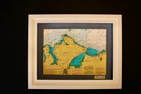
This lovely B&W chart features the area from Brownstown Head in Tramor Bay to Hook Head in Co. Wexford. In between are the coastal locations of Dunmore East, Passage West, Little Island and Duncannon. The estuary of the three sisters rivers (the Nore, the Suir and...
Hook Head to Duncannon
The estuary of the three sisters rivers (the Nore, the Suir and the Barrow) is central on this 3D chart. It divides Co. Waterford from the Hook Head peninsula in Co. Wexford. Dunmore East is the only village shown on the chart. It is a popular tourist and fishing...
Inishowen Peninsula
Attached are photos of two versions of the same area. Both are beautiful black and white charts of Inishowen Peninsula. Both features surround lighting and one has a Charcoal background with a black frame and one is finished with a black mount and a brushed silver...
Irish Sea
This beautiful B&W chart features the Irish Sea including the Isle of Man. The Irish coast that is visible stretches from Strangford in the north of Ireland to Bray in County Wicklow, The Isle of Man is featured in its entirety. It is located in the middle of the...
Ireland
This lovely chart features Ireland, being home to Latitude Kinsale. Ireland is an island in the North Atlantic Ocean, in north-western Europe. It is separated from Great Britain to its east by the North Channel, the Irish Sea, and St George’s Channel. Ireland is...
Kenmare River, Brushed Silver Frame
Kenmare Bay or (Kenmare River as it is titled on this chart and sometimes known as) is an abundantly scenic part of Co. Kerry. It separates the Iveragh Peninsula and the Beara Peninsula, with Kenmare town located at the head of the Bay. Kenmare town is seen on this...
Kenmare River, Colour
Kenmare Bay or (Kenmare River as it is titled on this chart and sometimes known as) is an abundantly scenic part of Co. Kerry. It separates the Iveragh Peninsula and the Beara Peninsula, with Kenmare town located at the head of the Bay. Kenmare town is seen on this...
Kenmare to Cork, Colour
Attached are photos of two versions of the same area. Both are beautiful colour charts of Kenmare to Cork. Both features surround lighting and one has a Carbon background with a black frame and one is finished with a black mount and white frame on a vinyl carbon blue...