

Popular
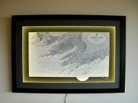
Valentia to Cork
The south west coast of Ireland is known for its beauty and is a major holiday location whether by land or by sea. It captures the south-west coastline from Valentia Island, Co. Kerry to Cork Harbour, Co. Cork. The coast is rugged which always makes for a chart that...
Youghal to Waterford
This chart features the coastline from Youghal to Waterford. In between are the coastal locations of Dungarvan, Tramore and Dunmore East. Youghal is a seaside resort town in County Cork, Ireland. It is located on the edge of a steep riverbank of the River Blackwater....
Tory Island to Bloody Foreland
This beautiful chart features Tory Island. Tory Island is 14.5 km off the north-west coast of County Donegal, Ireland, and is the most remote inhabited island of Ireland. The island is approximately 5km long and 1 km with an area of 3.581 km2. Tory has no airport, but...
Tralee Bay, Colour
This chart features Tralee Bay, which is located in the west coast of County Kerry, Ireland. Tralee Bay is situated between Kerry Head on the north side and the Maharees on the west and extends eastwards as far as the bridge at Blennerville. Several small rivers feed...
Tralee Bay and Magharees
Magharees (or Maharees) is a 5 km long tombolo located on the northern side of the Dingle Peninsula in County Kerry, Ireland. The peninsula is a sandy spit for much of its length, with sand dunes giving way to earth and rocky ground towards the northern end. Lengthy...
Tralee Bay to Cork SW Ireland
This chart is focussed on the southwest coast of Ireland. It is one of the country’s premier tourist areas. This chart encompasses the area from Tralee Bay to Cork. In between are the coastal locations of Dingle, Kenmare, Bantry, Baltimore, Glendore, Clonakilty,...
Tralee Bay, ORIGINS
This chart belongs to our Origins range. This chart features Tralee Bay. Tralee Bay is situated between Kerry Head on the north side and the Maharees on the west and extends eastwards as far as the bridge at Blennerville. Several small rivers feed into the bay through...
Tramore to Hook Head
This lovely B&W chart features the area from Brownstown Head in Tramor Bay to Hook Head in Co. Wexford. In between, Dunmore East and Creadan Head are shown. The estuary of the three sisters rivers (the Nore, the Suir and the Barrow) also shown on the chart. Hook...